
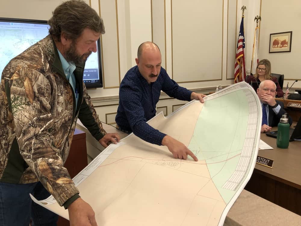
The Colusa County Board of Supervisors on Tuesday introduced yet another map of the potential new supervisorial district boundaries at the county’s fifth of six public hearings.
The decennial exercise to redraw electoral districts to keep populations as near equal as possible turned out to be more complicated than initially thought, after Chairman Gary Evans (District 4), realized late in the process there was a problem with what the board had previously hoped would be a final rendering.
Officials said the 2020 census data revealed that Colusa County has a population of 21,898, an increase of only 479 people since the 2010 census, but with growth largely occurring in just Arbuckle and Williams, forcing a complicated shift of all five district boundaries.
While the proposed map presented on Nov. 23 met the board’s unanimous approval and had clean boundary lines and balanced populations, Evans realized over the weekend that the problem was not how many people were in his district, but who they were.
“In the wee hours one morning I flashed on something,” Evans said. “After we did our redistricting in Williams, I wondered how much of District 4’s population was in the city limits of Williams. After doing some review with (Public Works) staff, it turned out that the way we had set it up was that 51.5 percent of the entirety of District 4 was inside the city limits of Williams,” Evans said.
District 4 is the largest district geographically in Colusa County, and includes Evan’s hometown of Stonyford, west to the Lake County line; all of Maxwell, east to the 2047 canal, and parts of Williams.
Because District 3 increased in population and District 4 decreased in population, District 4 was forced to take in more people when the boundaries were proposed during the Nov. 23 public hearing.
The problem with Proposed Map D, as Evans saw it, was that it met the criteria for balanced populations, but failed to keep communities of interest intact, which is also a legal requirement. Instead, the previous proposal shifted a large number of people with urban needs (City of Williams) into a district that is largely rural farmland and has rural needs.
“Knowing how vast District 4 is with the different communities, I thought that it was inappropriate that over half of the entire constituency (would be) in the city of Williams,” Evans said.
Working with District 3 Supervisor Kent Boes, who represents the Williams population located largely within the city limits, the pair came up with a fifth and final map (Proposal E) that returned a number of Williams city dwellers to District 3 and allowed District 4 to pick up more rural residents to the west, south, and east of the city, giving it a 58 percent rural population.
Proposed boundary map E, available for viewing at county of colusa.org., will be adopted at the Board’s Dec. 14 meeting without a first ordinance reading, as election codes take precedence over general law in matters of redistricting, officials said.
County Administrative Officer Wendy Tyler said the county must have the boundaries approved by the state’s Dec. 15 deadline.
The final adoption will allow election officials to begin drawing new precincts to match the new district boundaries, while preparing for the June 7 primary election.
The candidate filing period will open Jan. 3.